Caribbean Coverage
Area Coverage & Donut Charts
This section displays the area in 1000km2 of Terrestrial and Marine areas in the Caribbean that are protected. The Pie charts display the same coverage as a percentage.
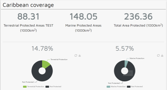
The coloured 1) rectangle buttons at the bottom of the chart can be clicked to view or hide the respective category on the chart. This and all charts have both the restore and download icons. The 2) restore icon makes all categories visible again. The 3) download icon downloads the chart as a PNG image.
Table
This table shows the list of Caribbean countries with protected areas along with other detailed data. This and all tables can be sorted by clicking the arrows next to the chosen column.
The white arrow indicates how the table is currently being sorted. Tables are sorted in ascending order by the first category by default.
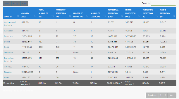
You can search for a specific country by entering it into the 1) search box and the table will be filtered. You can navigate the search results using the 2) navigation bar in the bottom right corner, or export the search results in various formats by clicking on the 3) buttons “Print”, “Copy” or “CSV”.
(Paste copied table data in a spreadsheet for best results). To clear the search, simply backspace the contents of the search field.